Reef regions
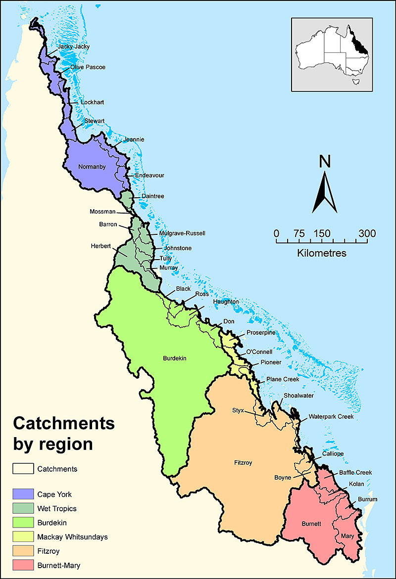
The Great Barrier Reef receives runoff from six natural resource management regions and 35 catchments which drain 424,000 square kilometres of coastal Queensland:
- Cape York region
- Wet Tropics region
- Burdekin region
- Mackay Whitsunday region
- Fitzroy region
- Burnett Mary region
For each region, catchment profiles provide information on the size, average rainfall, main land uses, sources of water pollutants and priorities for improving water quality. These profiles are part of the Spatial Management Prioritisation framework, which is a decision-support tool that provides practical guidance for targeted management options to improve Reef water quality.
The Great Barrier Reef catchments are largely rural and dominated by summer monsoonal rains and occasional cyclones delivering sediments, nutrients and pesticides to the inshore and sometimes offshore reef in pulsed flows.
Around 16% of the catchment is used for conservation purposes. Grazing (over 70%) is the dominant agricultural land use, particularly in the Burdekin and Fitzroy regions. Sugarcane (1.2%) and horticulture crops (0.2%) are more prevalent on the coastal floodplain with high rainfall and irrigation. Grain crops and irrigated cotton are prevalent in the inland areas of the Fitzroy region. Small urban centres are located on the coastal strip.
Habitats include wetlands, reef, seagrass and mangroves, and continental and coral islands are present. Reef-based tourism, as well as commercial and recreational fisheries, are an important part of the regional economy.
Water quality targets have been set for the catchments that drain to the Great Barrier Reef.
- Last updated
- 5 August 2026